


Shoreview P-3, Ramsey County, Minnesota
About
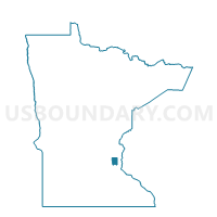
Outline

Summary
| Unique Area Identifier | 603911 |
| Name | Shoreview P-3 |
| County | Ramsey County |
| State | Minnesota |
| Area (square miles) | 1.74 |
| Land Area (square miles) | 1.62 |
| Water Area (square miles) | 0.12 |
| % of Land Area | 93.05 |
| % of Water Area | 6.95 |
| Latitude of the Internal Point | 45.06602530 |
| Longtitude of the Internal Point | -93.11625130 |
Maps


Graphs
Select a template below for downloading or customizing gragh for Shoreview P-3, Ramsey County, Minnesota


Neighbors
Neighoring Voting District (by Name) Neighboring Voting District on the Map
- North Oaks P-1, Ramsey County, MN
- Shoreview P-2, Ramsey County, MN
- Shoreview P-4, Ramsey County, MN
- Shoreview P-5, Ramsey County, MN
- Vadnais Heights P-1, Ramsey County, MN
- Vadnais Heights P-3, Ramsey County, MN
Top 10 Neighboring County Subdivision (by Population) Neighboring County Subdivision on the Map
- Shoreview city, Ramsey County, MN (25,043)
- Vadnais Heights city, Ramsey County, MN (12,302)
- North Oaks city, Ramsey County, MN (4,469)
Top 10 Neighboring Place (by Population) Neighboring Place on the Map
Top 10 Neighboring Unified School District (by Population) Neighboring Unified School District on the Map
Top 10 Neighboring State Legislative District Lower Chamber (by Population) Neighboring State Legislative District Lower Chamber on the Map
Top 10 Neighboring State Legislative District Upper Chamber (by Population) Neighboring State Legislative District Upper Chamber on the Map
Top 10 Neighboring 111th Congressional District (by Population) Neighboring 111th Congressional District on the Map
Top 10 Neighboring Census Tract (by Population) Neighboring Census Tract on the Map
- Census Tract 406.04, Ramsey County, MN (7,053)
- Census Tract 407.03, Ramsey County, MN (6,734)
- Census Tract 407.04, Ramsey County, MN (5,410)
- Census Tract 406.03, Ramsey County, MN (5,252)
- Census Tract 406.01, Ramsey County, MN (5,016)
- Census Tract 407.07, Ramsey County, MN (4,066)